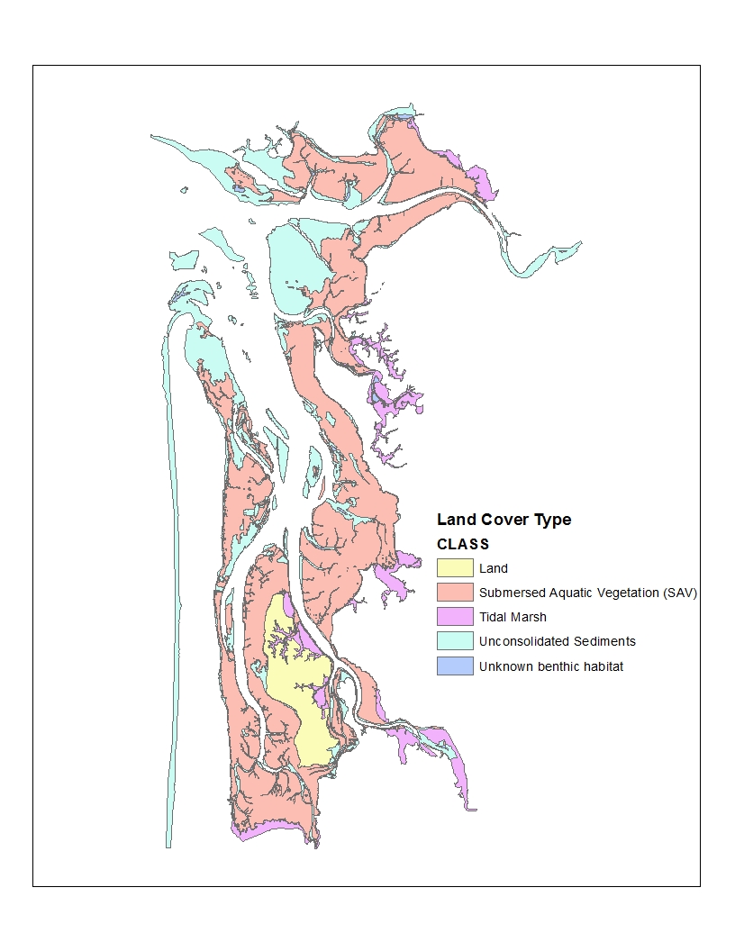
In preparation for a class trip to the Oyster capital of the US, Willapa Bay (which unfortunately I was unable to attend), I put together two spatial analyses of the land cover and bathymetry in the Willapa Bay estuary, in partnership with my colleague Marlon Jiménez Oviedo. The results were two mock reports, the first written as if reporting to the funding sources for an investigation on land cover: find it here. The second was written as a National Geographic article reporting on the bathymetry (depth and tidal analysis) of the bay: find it here.
GIS is one of my favorite methods of analysis, and lends itself particularly well to the spatial and distributive concerns that I am interested in when it comes to urban development. As such, it is always agreeable to have the opportunity to brush up on my GIS skills and learn a few more.