by Audrey Stuart, Liza Tugangui, Blake Slattengren
Background
This lab used arcGIS mapping features to examine issues of environmental injustice within the city of Portland. GIS is an easy way to look at trends across city blocks to understand how various factors may be related to environmental health. The ultimate goal of our analysis was to determine which external factors affect levels of diesel particulate in the air. We looked at the presence of freeways and factories, median age of population, percent of population under $25,000 annual income, and employment rates in relation to diesel particulate levels. The diesel particulate levels are expressed as the ratio of measured concentration of diesel particulate matter to ambient background concentration. Therefore, any value greater than one means the levels in Portland’s air is greater than what an individual can breathe during their lifetime without adverse health effects. The Oregon DEQ modeled 17 different air pollutants that are all of concern to Portland’s residents. For simplicity and the purpose of this lab we narrowed our analysis down to one pollutant, diesel.
Diesel air pollution is relevant to Portland because the measured level is more than ten times greater than the accepted benchmark. This is an issue because the health effects it can cause include lung cancer as well as respiratory and heart problems.
Procedure
Individually, each of our group members started with a map of Portland, in which we added layers of major streets and rivers in ArcGIS. With our goal of finding correlation between different sets of data, we chose to focus on one control variable, that of ratio of concentration of diesel particulate matter, with three other variables of possible causation. This included the median age of civilians in Portland, areas of low income households, and amount of civilians employed in an area. Separately, we placed each of these sets of data on a layer of the map with diesel particulate matter and tried to look for trends in areas of high concentration of diesel.
Results

Discussion
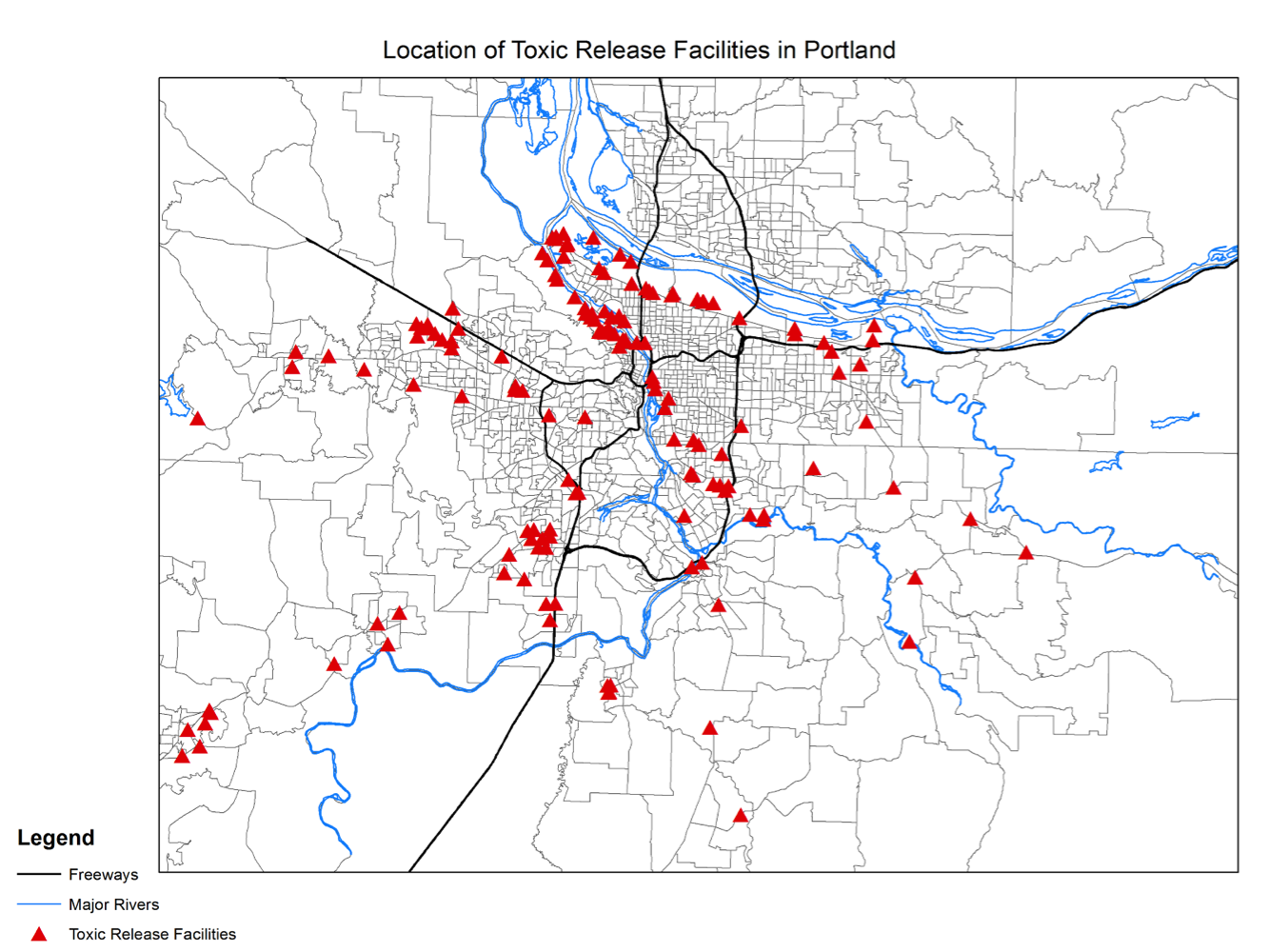
The first map shows a clear correlation between location of toxic facilities and proximity to rivers. It also appears that many of the facilities are located near a freeway. This is important because it shows that factors such as rivers and freeways impact the location of toxic facilities even before any socio-economic factors are added. This was expected because ease of transport is a major consideration in citing. However, as we learned in this lab, discrepancies in siting cannot be used to prove environmental injustice unless the health risks are also proved. This first map also provided valuable background information by guiding us to certain areas where toxic facilities were concentrated.
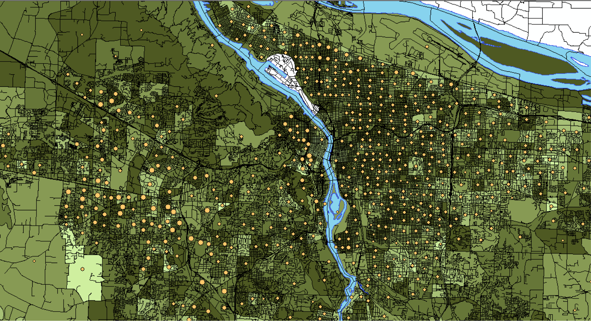
The second map looks if median age is correlated to diesel particulates. The area with high density diesel particulates tend to be located in similar areas as younger people live. There may be a weak correlation, but there are also plenty of areas with younger people that show lower levels of diesel particulates. It is then hard to tell whether or not there is a correlation at all, more studies would need to be done. If there is however, this might suggest that younger people in Portland drive more often, releasing more diesel particulates. This also could be an area of concern because exposing youth to more air pollution over time could have greater lifelong effects.
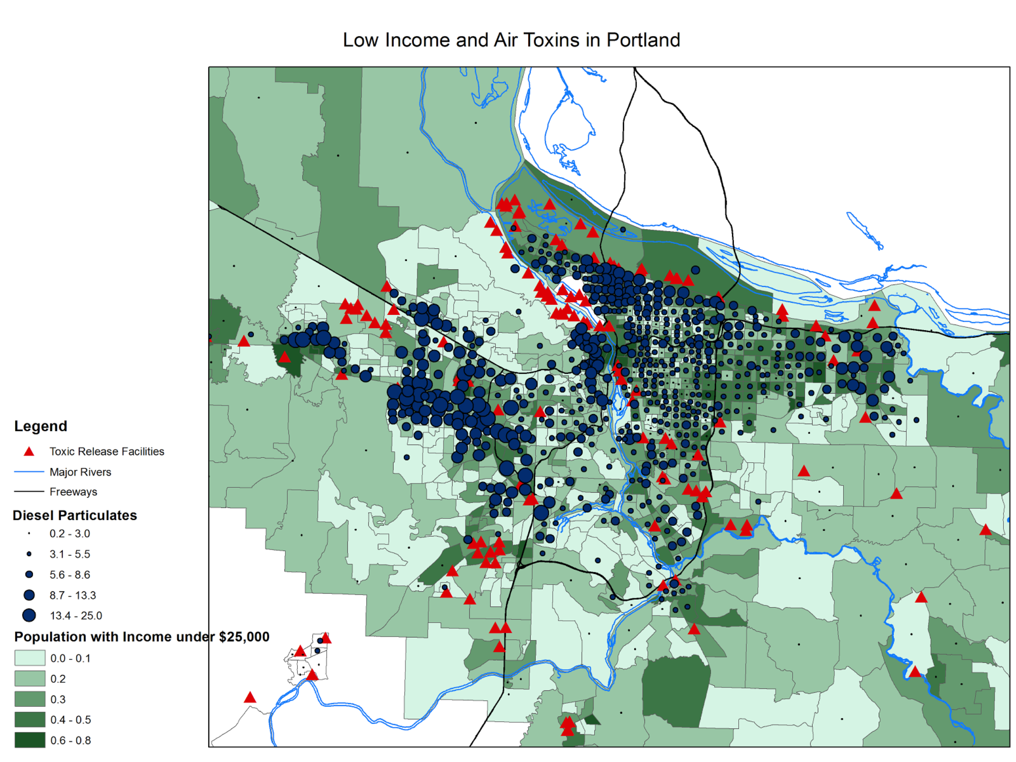
The third relationship we examined was between low household income and areas with high diesel particulate levels in the air. There were several clusters where the diesel particulate levels appeared greater than in other areas. These areas with higher diesel particulate ratios had varying proportions of the population with an income less than $25,000. The areas with high diesel particulate levels were usually near freeways, so the diesel particulate is likely from the vehicle traffic. Certain regions near the middle of the map had more people with low income, very close proximity to freeways and more toxic release facilities. There is a likelihood that the land in these areas is cheap because it is not desirable to live next to a freeway or a toxic facility. In this case, more people with an income under $25,000 may have moved there because it was affordable. This means the toxic facilities would not have been purposefully placed in poorer areas, but may have further reduced the property values there. The areas with the highest diesel particulate levels were in close proximity to both a river and a freeway.These areas generally also had more people with an income under $25,000, though the correlation was not quite as strong. Our findings match those of the Portland Air Toxics Solutions project conducted by the DEQ, which found that those living below the poverty line faced a larger impact of pollution from cars and trucks.
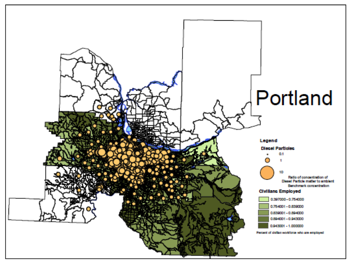
The last map shows the comparison of the concentration of diesel particulate matter and the percentage of civilians in an area that are employed. We can see from first, more zoomed out, map that the clusters of circles, which represent the concentration of diesel, is more concentrated in the middle of Portland around the river, which is the area of downtown. Downtown sees a lot of traffic, so naturally this accounts for why the diesel concentration is high. A lot of traffic is a lot of auto emissions. However, in relation to the percentage of civilians, which is signified by a gradient of green, darker green being a higher percentage, there is a small trend of diesel particles. They both appear to cluster around the downtown area as well as the surrounding suburban areas. This makes sense because a large proportion of the Portland area does commute downtown so whether or not the civilian who works in the city, either commutes long distance or short, his or her emissions are going to eventually end up in that area, causing a higher concentration.
To conclude, diesel toxins are an area of huge concern for Portland, particularly for marginalized, poor neighborhoods. A big source of this seems to come from the toxin-emitting factories. Many of these facilities need to be near flowing water, so having them in Portland, an urban, easily-accessible area where there are several rivers and streams, makes a lot of sense, but it is not only problematic, but actually dangerous, for minority communities who have to live near these facilities and breathe in toxins. Moving forward, it is important for new facilities, in Portland and in other cities around the world, to only be erected with careful thought and consideration from multiple parties. Ideally, these facilities could also move to less populated areas and release less toxins. As is though, it is important to be concerned with the health ramifications of population demographic shifts.