Map and Text By Laurel Garrett and Jhana Valentine
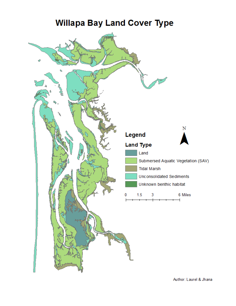
This benthic habitat survey (1995) has been completed by the Columbia River Estuary Study Taskforce, NOAA Coastal Services Center, Oregon State University, Washington State Department of Natural Resources, Washington Department of Transportation, Marine Resources Consultations Inc., University of Washington, and the United States Geological Survey. The study consisted of collecting data on the land types in Willapa Bay, Washington. The primary method was color aerial photography, and videography and field surveys were used to verify. The findings show that the majority (55%) of Willapa Bay land is made up of submerged aquatic vegetation (SAV). The second most prominent land type present in the bay is unconsolidated sediments, which make up 29% of the bay. Unconsolidated sediments are loose materials, such as clay, gravel, and sand, that groundwater can flow through (USGS). The remaining 17% is split between tidal marsh (9%), land (7%), and unknown benthic habitats (1%). Although tidal marshes make up only 9% of the bay, they are significant because they provide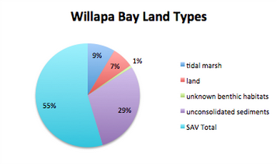 the necessary conditions for shellfish farming, an important facet of the local economy. The large amount of SAV cover in the bay is likely dominated by eelgrasses, such as zostera japonica andzostera marina and the invasive cordgrass, Spartina alterniflora. Between 1995, when this survey was completed, and 2003, upwards of $10 million dollars have been spent to eradicate Spartina alterniflora (Patten). This survey has successfully documented the presence and prevalence of five distinct types of land in Willapa Bay. Furthermore, it provides a detailed picture of Willapa Bay land type coverage after the invasion of Spartina, but before major eradication projects had begun.
Sources
USGS: http://www.usgs.gov/faq/node/2777
Kim Patten’s Power Point: http://longbeach.wsu.edu/spartina/documents/spartinacontrolinwillapabayasuccessstory-talkatapms2006.pdf