In ENVS 220 (Environmental Analysis), the sophomore-level ENVS class, students learn several different methods they can use in their research. After developing these skills, they put them to work in a situated research project, done in small groups. This project is one of the first times ENVS students tackle the situated approach, one they will need to use throughout their years at Lewis & Clark. As noted on our situated research page,
Situated research brings environmental issues into a geographical lens, examining a range of processes and perspectives at multiple temporal and spatial scales as they converge at a particular location, region, or network of locations. Situated research offers a real-world context for interdisciplinary environmental research, and suggests important geographical patterns we should keep in mind as we attempt to understand and solve environmental issues.
Students typically do situated research via an hourglass approach, in which they start with a general environmental issue (top of the hourglass) and pose one or more framing questions that motivate the research. A framing question tends to be broad, unanswerable, and can be situated anywhere. The middle of the hourglass is the situated context which focuses on a specific place and the environmental issue within that place. The bottom of the hourglass zooms out from the situated context and considers broader implications and future research.
This year, the 220 projects were clever and well executed. Two projects specifically stand out and are featured in this post; Portland Food Systems and the Cascadia Earthquake by Emily Hays, Callie McMahon, Emily Tucciarone and Samuel Bundenthal, and New Zealand: Indigenous Perspectives and Ecotourism by Anna Foster, Ariel Moyal, Nick Sievers and Sean Logan.
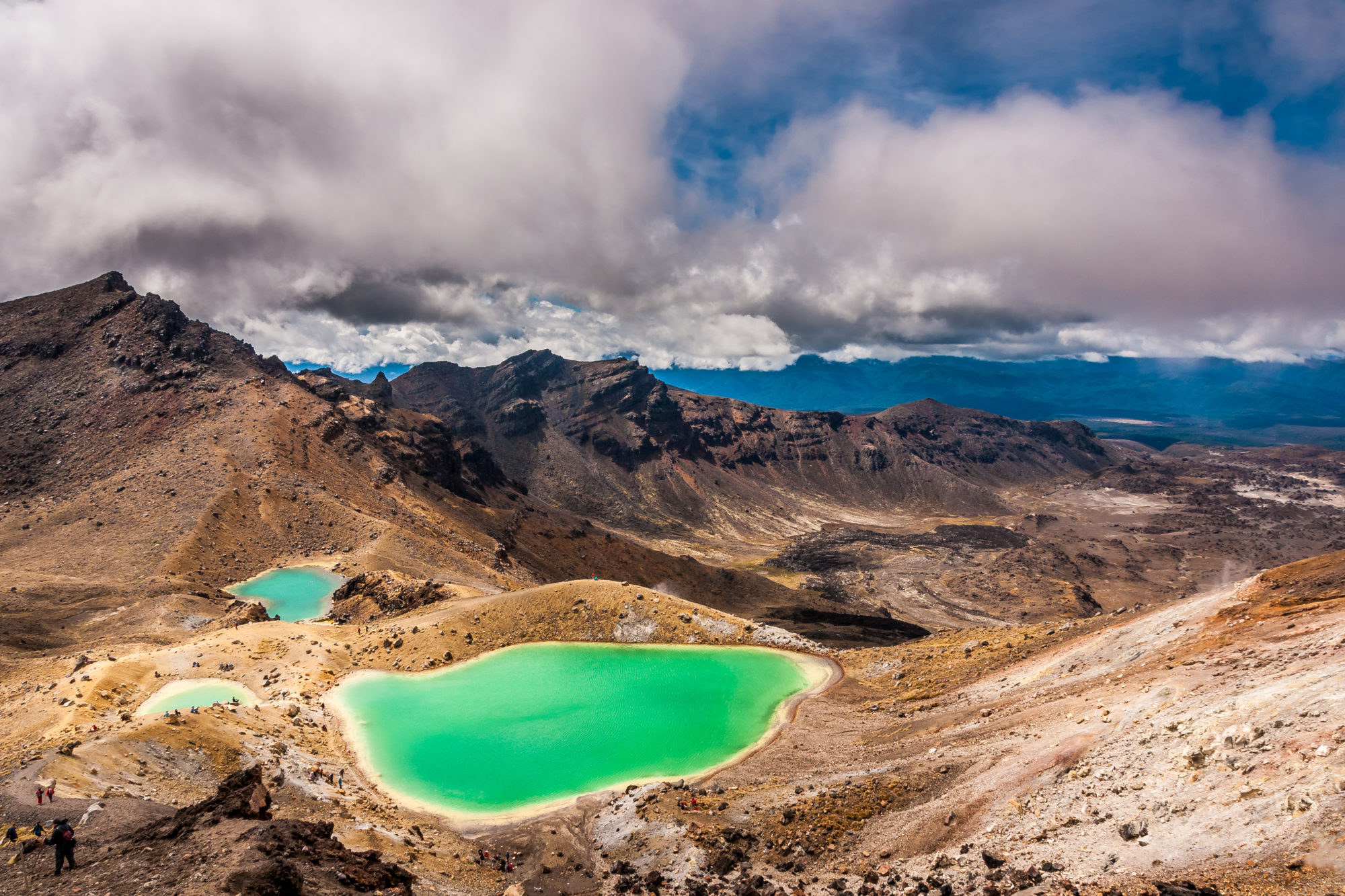
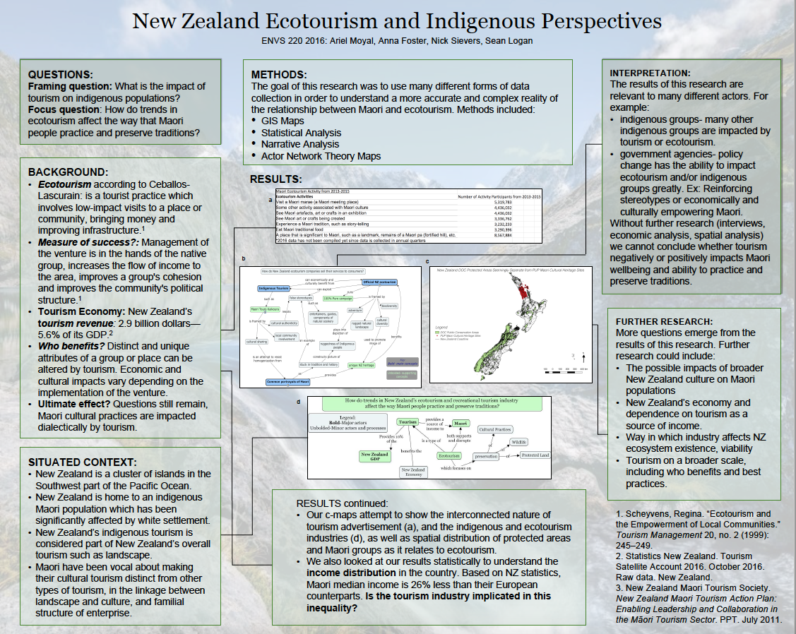
In the project New Zealand: Indigenous Perspectives and Ecotourism, the teammates were interested in the effects of tourism on New Zealand’s indigenous peoples. They started their project with the framing question that motivated their research. In this project, they asked, “What is the impact of tourism on indigenous populations?” Their focus question, on the other hand, is situated in a specific place. The impact of tourism on indigenous populations is different depending on where you are. Tourists in Chile would have a different impact on the indigenous peoples than tourists visiting Northern Canada. This project focuses on Maori people in New Zealand. They ask, “How do trends in New Zealand’s ecotourism and recreational tourism industry affect the way Maori people practice and preserve traditions?” This group analyzed the interaction between ecotourism and Maori groups rhetorically, spatially, and statistically. More specifically, they used GIS mapping to look at the spatial relationship between protected areas and Maori cultural sites, statistical analysis to look at income distribution among the population, and rhetorical analysis on New Zealand tourism company advertisements and websites.
A semester after completing the project, I asked the group to reflect on their work. Anna Foster said, “The most difficult part of our project was finding data that we could use for our methods, specifically for GIS mapping and narrative analysis. If I were to do the project again, I would revise our research question to something more realistically researchable.” This problem comes up frequently when working with GIS data. Often times researchers using GIS have to change their focus questions depending on the data available.
In the interpretation section of their project, they really focused on the hourglass approach by zooming in and out of different scales, giving context, and discussing other implications of the research. Group member Nick Sievers says, “If we had more time to work on our project, I think making an analysis of the New Zealand census would be particularly interesting if overlaid on a map of New Zealand’s Maori Heritage areas. I would have wanted to plot various occupations relating to cultural preservation and/or ecotourism, but I recognize it may be hard to compile.” Their final product is a poster of their project (shown below) with all the sections of the situated approach.
Situating research in a place that is well-known to the researcher can give research a leg up. In Portland Food Systems and the Cascadia Earthquake, the group members’ knowledge of the Portland area did help them in their methodology, analyzing their results, and interpreting them. Many ENVS 220 projects are done using an outsider’s perspective, mainly collecting sources for information rather than creating a methodology and following the steps through it. This group was able to use their first-hand knowledge of the Portland area and Lewis & Clark College to create a project. The background section of their project sets them up for clear and motivating framing research questions. The background doesn’t mention Portland but rather discusses earthquakes around the world in different settings. They ask in their framing questions, “What factors determine a city’s resilience to earthquakes? … How does individual preparedness affect the preparedness of a community?” The situated context of their project is in Portland, Oregon, and specifically Lewis & Clark College. In this section, they reference other studies that have been focused around Portland and the Cascadia Earthquake. Their questions are
How prepared are Portland residents and neighborhoods to handle the earthquake?
Who is most susceptible to the effects of earthquakes in Portland?
How accessible is food in Portland in face of a disaster?
This group found that food systems matter once they are specifically situated in a neighborhood. South Burlingame, Portland is unified in its geography, but less so in its community. This could leave South Burlingame more vulnerable to food stressors after the Cascadia Earthquake. When asked about future research, Sam Bundenthal said,
I’d like a more comprehensive look at the effects of the Cascadia Earthquake on our city. We started this project because all the literature we could find didn’t really talk about food and prioritized the immediate effects of the quake, like buildings that were going to stay up and the damage that would be caused to infrastructure. No one was really talking about the kind of post-disaster fallout we’re going to see in that two-week period AFTER the quake when we’re struggling to get aid to people who need it. That’s the whole idea of food security, and why it’s often overlooked; a lack of food security, real or perceived, means we’re going to see a lot of people who are desperate and confused and very much willing to loot and cause chaos. We know that’s not going to end well for anyone involved.
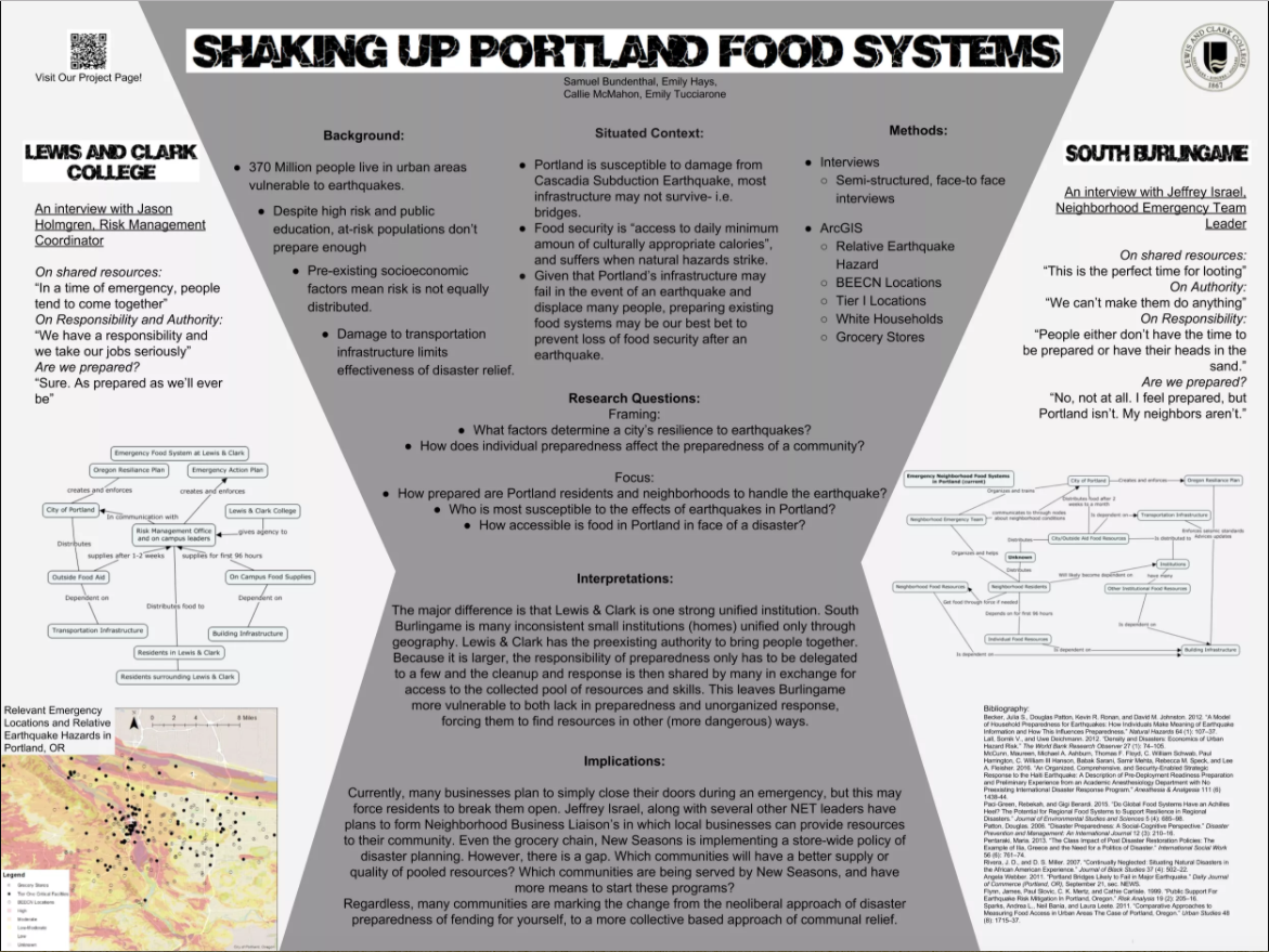
Situated projects in the environmental studies major are meant to be interdisciplinary and show a variety of skills and methods. These projects work to find broader implications that expand farther than Portland, New Zealand, or anywhere else one may situate a project. Portland Food Systems and the Cascadia Earthquake displayed their diversity of methods by using ArcGIS and interviews. New Zealand: Indigenous Perspectives and Ecotourism looked beyond New Zealand, thought about other indigenous groups, and pulled it all together by saying policies created by the government have the ability to impact ecotourism and/or indigenous groups greatly and will differ depending on where you are.