Note: The below last updated in 2015. As Google Maps applications continue to evolve, some of what you read may not be current.
Please email us if you’d like to recommend updates to this documentation.
Maybe your mapping needs don’t involve advanced spatial data analysis via GIS applications; in that case try Google mapping options for a simpler user experience! To compare the two Google tools below to each other and to more advanced GIS applications, see here.
Google My Maps
Google My Maps is an easy way to create custom maps that can be shared and published online. Google My Maps allows for simple styling and organization of your map data, and it’s possible you may want to begin your styling on this program and move on to Google Earth for more advanced styling later.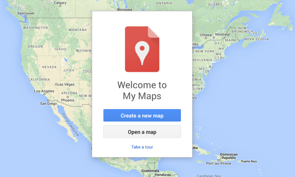
Placemarks and lines can be manually added, but if you already have geographically defined data, you also have the ability to import your data in the form of a CSV, KML, KMZ, XLSX file, or a sheet from Google Drive. These files will need to include addresses, place names, or latitude and longitude coordinates in the correct format—e.g., Lewis & Clark College is 45.4509, -122.6701. (Note: for images to display in My Maps they need to be online; i.e., images that are included in a KMZ file won’t show.)
You can finish editing your data by exporting the map as a KML so that it be opened on Google Earth or other applications that read KML. Another way to deliver your work is by sharing the URL on Google My Maps; or, you can embed it on your DS site via the embed feature and iframe plugin.
If you are looking for a simple map of Google Sheet data, consider the geo chart option.
Google Earth
For more advanced styling and data format options (like adding your own images), Google Earth is a 3D globe and spatial data environment that can be installed on the desktop of your computer, a web plug-in on your internet browser, or an application on your mobile Android or iOS device.
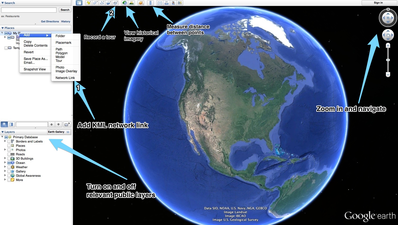
Getting started with Google Earth is easy. The desktop interface provides an interactive globe where users can explore the planet, as well as add and view their own spatial data layers. Google Earth uses a spatial data format called KML (or KMZ for a zipped version including imagery and other files). Two special features of Google Earth we recommend are network links and tours (see image below for these and other features):
-
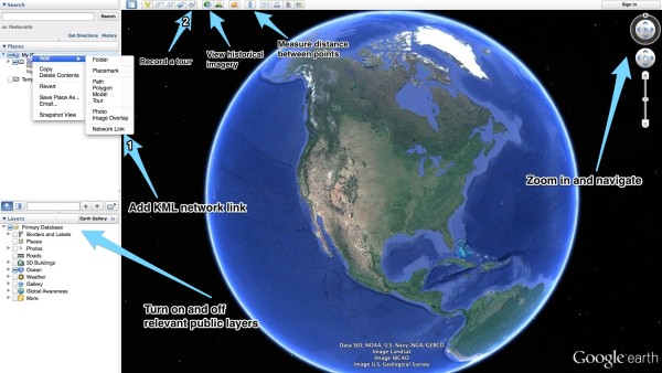
Click image to expand
Network links reference an online KML file archive (e.g., http://myServer/kml/example.kml); this way, you can readily store and share KML files. We are using GeoServer to share a variety of spatial data via Google Earth network link. After adding a network link on the Google Earth interface, you will be able to double-click and zoom to one or more KML layers under My Places.
- The Record a Tour feature on Google Earth provides a way to record customized map-based narratives of places around the world. The Creating Tours help page will guide you through this process.