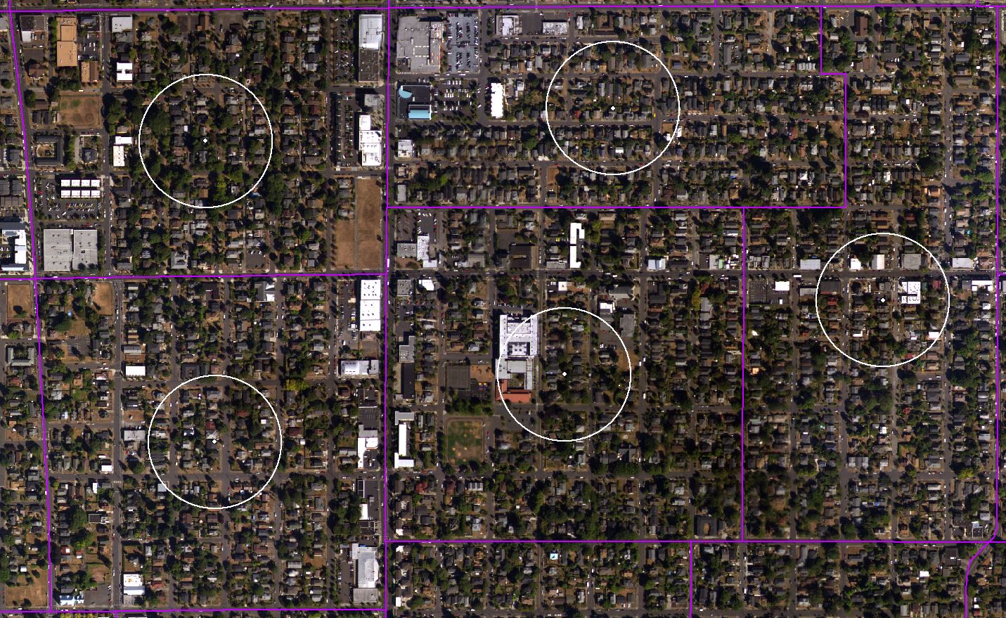
 For my first attempt at quantifying the amount and distribution of Portland’s tree canopy, I used the GIS methodology I know best, which involves drawing polygons within a sample area. My basic unit of analysis for Portland was and is the American Community Survey Block Groups, shown above outlined in purple. After obtaining a geodatabase of Block Group data from ACS, and constructing a giant raster of Portland Orthoimagery based on USGS Aerial Photography, I created a sampling area within each block group. I did this using ArcMap’s Centroid tool to interpolate a point in the geographic center of each block group, and the Buffer tool to create a 100 meter radius around each of those points (shown above in white).
Now came the process of drawing polygons. This means that, for each sampling area, I was quite literally tracing each tree so that ArcMap would know it was an area of canopy. A problem with this methodology quickly emerged when I discovered that covering a single 100-meter-radius sampling area in polygons would take me about an hour—and Portland has 994 Block Groups. Not being able to spend my time from now until March tracing trees in my data, I decided I need a new methodology. It’s time to investigate Image Classification!