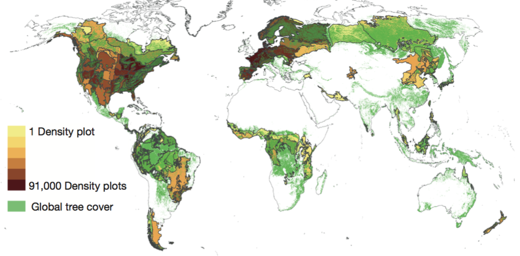
An article by Crowther et. al, just published in Nature, undertakes an ambitious project to (as implied by the title) map tree density on a global scale. The study relies on ground-sourced measurements of tree density, but relates them to GIS and remote sensing data to construct a model of tree density. Based on the maps produced, they estimate that earth has 3.04 Trillion (3.04 x10^12) forest trees.
The number of trees in a given area can also be a meaning- ful metric to guide forest management practices and inform decision-making in public and non-governmental sectors14,15. For example, international afforestation efforts such as the ‘Billion Trees Campaign’, and city-wide projects including the numerous ‘Million Tree’ initiatives around the world have motivated civil society and political leaders to promote environmental stewardship and sustainable land management by planting large numbers of trees.
Although the article does not specifically address trees in urban areas, it does put individual cities within the context of tree density in their local biome. It also represents a huge-scale methodological use of data measurement, remote sensing, and regression models to estimate forested area.
