By Kamylli and Trisha
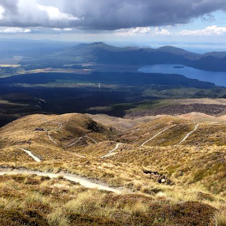
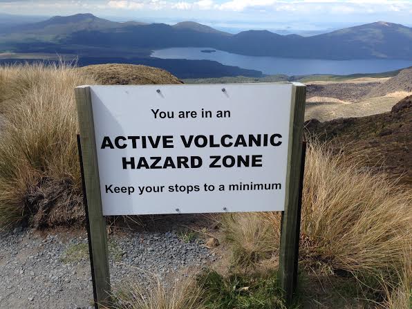
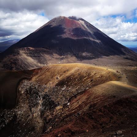
The first two weeks of our trip to New Zealand were spent exploring different areas of the North Island, a diverse environment full of dinosaurs (well, Tuataras at least), fantails, sparrows, kiwis, arachnids, rolling hills, beautiful coastlines, volcanoes, fault lines, greywacke, geothermal springs (bacteria and archaea galore), and a great many sheep. January 14th marked the day of our journey across a 19.4 km section of the Tongariro National Park. The Tongariro Alpine Crossing, recently given the ‘alpine’ name to better implicate dangers of the terrain to unprepared adventure seekers, is a one day trek through Mount Tongariro’s active volcanic zones. Tongariro and its neighboring volcanoes of the North Island are geologically and culturally significant to New Zealand. A Maori legend recounts that this area was arranged as a result of a conflict between Tongariro, Taranaki, and their brothers, Ngauruhoe and Ruapehu, over Pihanga, with whom they were all in love. Directly following their mighty battle, the lovely Pihanga stood tall next to Tongariro. Taranaki was then sent away (in some versions exiled, in others he angrily left) and moved until he reached the coast. His journey etched out a large trench in which a river now lays and he can still be seen by his brothers (and their visitors) during most points along the crossing.
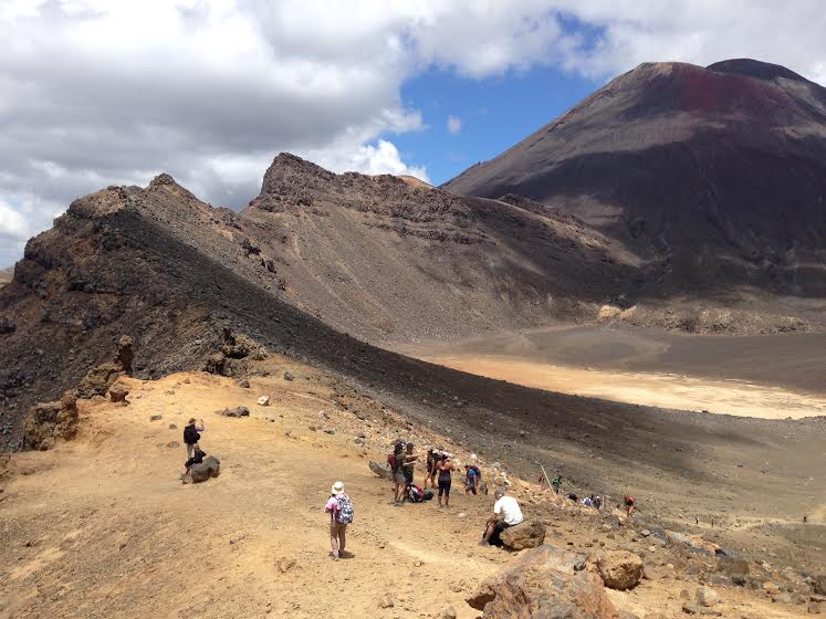
The first leg of the journey is a 1-1.5 hour easy walk from the Mangatepopo parking lot to the Mangatepopo hut at the base of the Devil’s Staircase. The Devil’s Staircase is exactly what it sounds like, an arguably hellish ascent from Soda Springs to the South Crater, at which point hikers can choose to turn off and climb Mount Ngauruhoe (aka ‘Mount Doom’). Most of the group decided to summit Doom, and a small number chose to continue on with the crossing. The first half of the crossing was intense at times, but worth the spectacular views along the way. The second half was mainly a descent through entirely different environments, ranging from dry sulfurous volcanic zones to lush, wet forest.
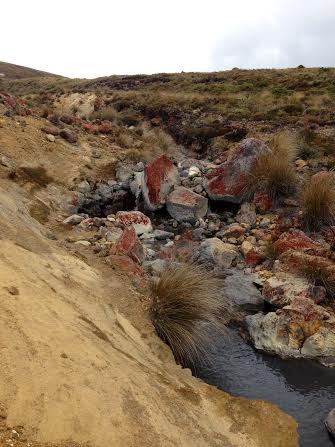
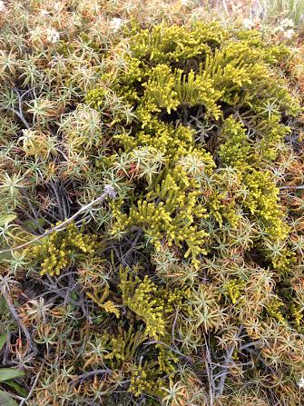
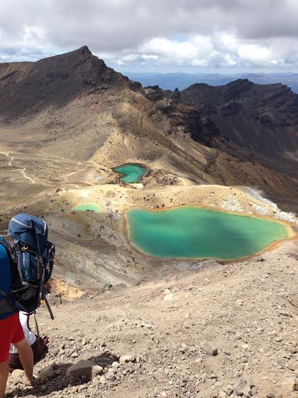
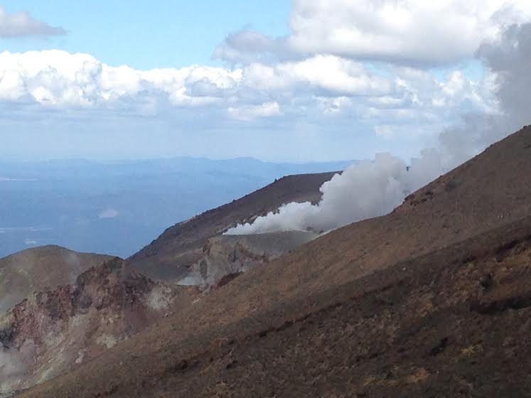
After Doom-goers turned off, we made our way to the South Crater, and then climbed a frighteningly exposed ridge to the highest altitude of the crossing, Red Crater. The view from the top was spectacular and humbling. There is nothing like being at 1800 feet, surrounded by a wide stretching landscape, to make you feel very small. We began descending the Red Crater summit clumsily, as the lay is steep and gravelly (perfect for falling and sliding off of one of the steep slopes of the hill). Fortunately a friendly woman vacationing from Germany held our hands and we made a mountain ascending human train to reach the bottom safely. Others went for it and slid their way down, but I felt like it was important to make good use of my new hiking boots and take it one step at a time. At the bottom of the slope was the first Emerald Lake, a beautiful blue-green body of water that sits in stark juxtaposition to the rest of the dry grey and red volcanic landscape. After having lunch next to the lake, we began our walk to the valley around Blue Lake, and finally began the true descent to the Ketetahi hut, a resting stop just 2 hours short of the end. The landscape began to change as we made our way from the lakes. We noticed small craters along the way, places fenced off for future study of the historic Taupo eruption, and more life the further we moved from the summit. Dry, rocky stretches transformed into areas marked by several alpine plant species and we crossed over a small river flowing in the direction of our descent. Alpine species turned into lower elevation plants, greener and taller, ferns and small trees popped up and we soon entered a green, dare I say, Pacific Northwest-ish forest. The terrain became flat, the air wetter, and the temperature dropped. It was like entering an entirely different world. We spent an hour or so traveling through the forest and eventually made our way successfully to the carpark where Michele and the Doom group joined us, completely exhausted and equally satisfied with their trek.
What struck me about the crossing was how humbling it is to stand at the top of a summit and feel completely insignificant. When looking out at the vast landscape around the summit, you can’t help but feel taken aback by the surrounding volcanoes and rivers and stretching land. Geographically speaking, this volcanic range is still very young and constantly changing, but its hard to imagine such a magnificent and impressive landscape ever changing at all.