
Over the final weeks of the program, we’ve seen more contemporary examples of how the volcano Mt. Fuji shapes lives. We’ve spent time at each side of the mountain, particularly noting the differences between the North, South, East and West flanks. The areas are distinct in their primary industries, susceptibility to natural disasters, and agriculture. The range of lava flows throughout Fuji’s eruptive history have created a patchwork of different geologic material on and around the mountain. The types and ages of these eruptions combined with a variety of weathering sources results in surfaces conducive to different uses. In looking at how this volcano affects ways of life, in terms of methods for agriculture and disaster control, one quickly notices how these forces cannot be discussed without discussing water. This interplay of Mt. Fuji’s volcanic material, water, and how humans respond to these forces has proven to be an interesting narrative. I outline a few major areas in which these three elements overlap around Mt. Fuji: agriculture, industry, and natural hazards.
Agriculture around Mt. Fuji varies greatly due to the different ages of lava flows. The fresh basalt from Fuji eruptions is incredibly permeable, which has been problematic for agriculture on the north side of Fuji. The soil does not retain enough moisture for a number of crops. Rice, a staple of Japanese cuisine, is all but impossible to grow on porous scoria, as rice paddies require standing water. Settlements in these areas have historically made the best use of the water available to them through impressive engineering. In 1675, the water-poor village of Arakura set out to divert water from Lake Kawaguchiko to their rice paddies (Fujisan Museum, July 25, 2017), but the project was abandoned. Later, villagers hand dug the 3.8 km tunnel through a mountain, finally completing the project in 1875. Otherwise, they’ve managed by growing hardy crops. Instead of rice, the more typical product in the north was mulberry (Batdorff 2014), the favored food of the silk worm. The silk industry played a huge role in the economy of the north, and trade supplemented the challenges facing agriculture. Today, the industry most economically vital to the north is tourism around the Fuji Five Lakes. 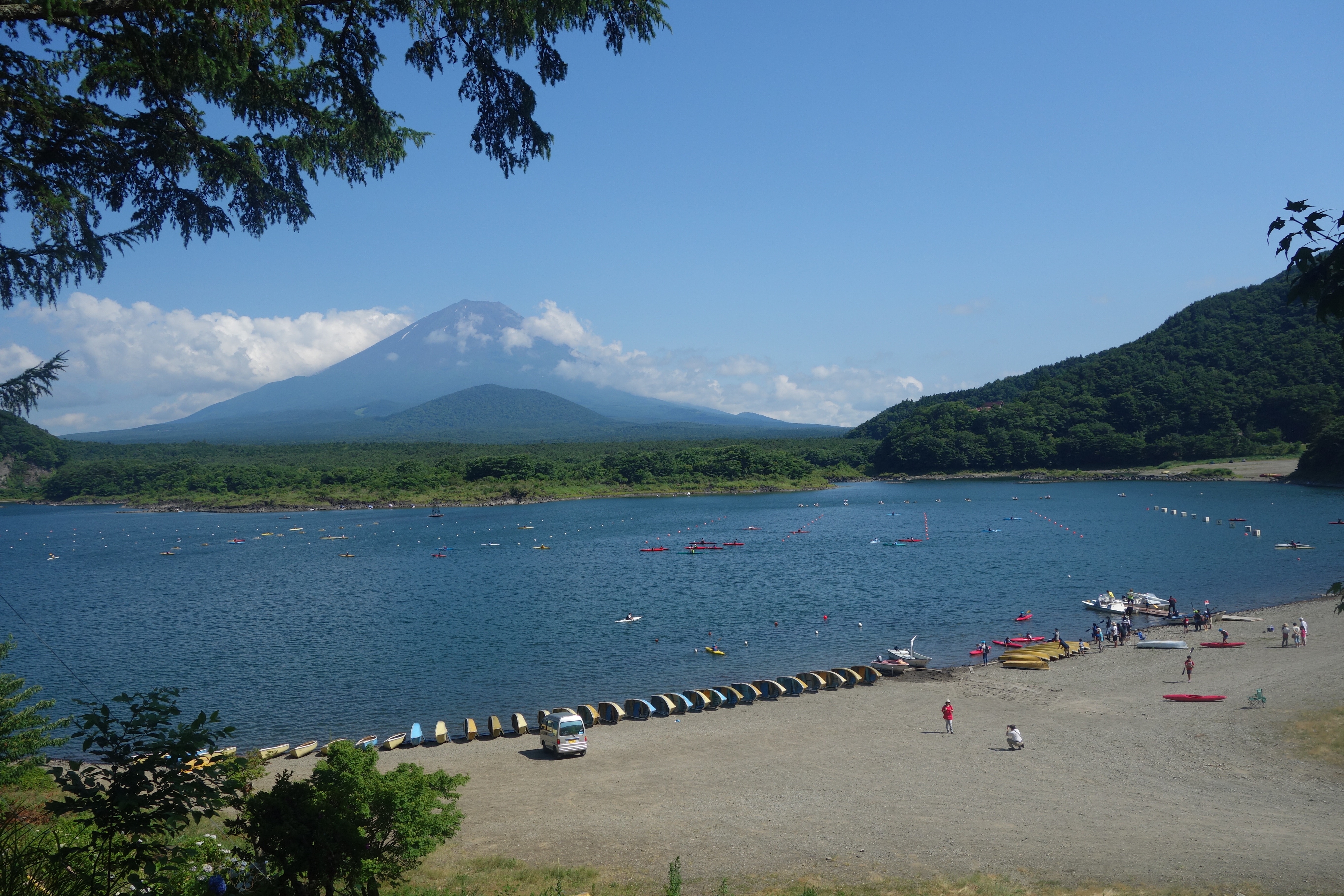 Snow and rain atop the mountain percolate down the northern side, pooling in areas where ancient lava flows have dammed rivers. These beautiful natural areas draw 30 million visitors each year (Tom Jones, August 2, 2017), providing the bulk of income to the region. On the south side of the mountain, however, water does not pool in lakes, but comes out in springs. The area is rich in ground water, which is used in a number of industries and factory operations.
On the south side, some areas on lava flows of Mt. Fuji eventually become more conducive to plant growth through weathering and infill from external materials (Deligne, 2012). This is due in part due to sedimentary deposits from debris and slush flows. While on the one hand they supplement poor soils, they have also long been forces of destruction in the area. They destroy crops, livelihoods, and whole cities. The slush flows can occur on any side of the mountain, though they are more frequent on the eastern side, which gathers both snow and volcanic debris. One of the most prominent sources of debris flows is the Osawa failure on the west side. Disaster prevention measures are now widespread. The erosion control works in the Osawa failure are incredible to behold, and crucial for controlling fast and extensive debris flows. 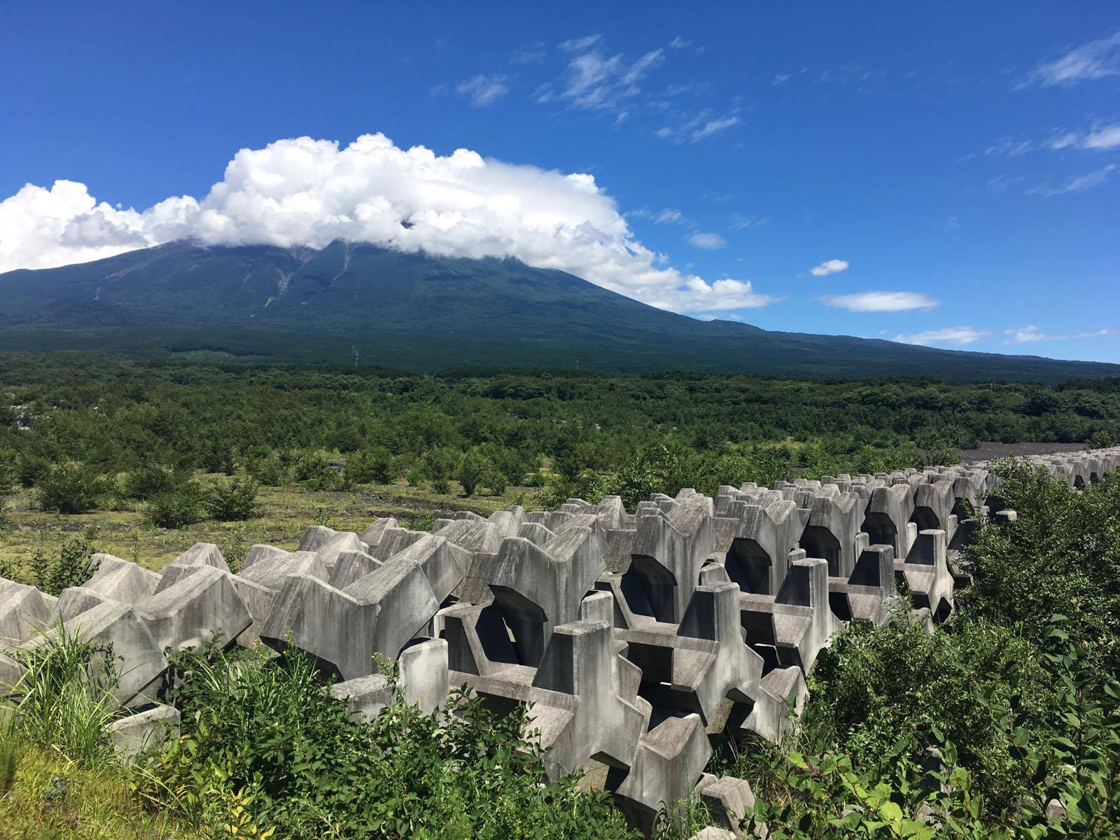
Yukishiro, or slush flow, is a type of mass movement that occurs from early Winter to late Spring. When the ground at the top of Fuji freezes in the winter, its typically permeable soil becomes impermeable. When this layer begins to thaw in spring, water can build up on top of the frozen surface, destabilizing the soil and snow and initiating a slush flow. These flows of thawed snow and soil pick up more debris on their way down the mountain, taking down entire forests (Sou Anma, August 8, 2017) and villages. A particularly destructive flow devastated Fujinomiya in 1835. Slush flows even affected the layout of the oshi village Fujiyoshida. The village was pummeled by an 1834 flow (Fujisan Museum, July 25, 2017). However, the town’s layout takes the common disaster into account. The typical layout of a shrine village has a main road leading up to the shrine, yet in Fujiyoshida, the town is located off to the side in order to avoid the main path of the slush flows. 
People have responded to Mt. Fuji’s geologic and hydrologic features in a variety of ways. Depending on how water and volcanic material interplay, conditions will be conducive towards certain industries and activities. The mountain shapes lives, as people seek to take advantage of its benefits and control its destructive forces.
Deligne, Natalia I., Katharine V. Cashman, and Joshua J. Roering. 2012. “After the Lava Flow: The Importance of External Soil Sources for Plant Colonization of Recent Lava Flows in the Central Oregon Cascades, USA.” Geomorphology, December. doi:10.1016/j.geomorph.2012.12.009.