
The Brahmaputra: Asia Sentinel
The Tibetan plateau in China is considered the water tower of Asia. It has become widely recognized that “[w]ater scarcity is set to become Asia’s defining crisis by midcentury” (Chellaney 2013). Although water is not the only growingly scarce resource in the region, it is arguably the most crucial one. Based on China’s ecological condition today, its land can be distinguished between two realms: the arid north, which holds half of the population and two-thirds of their farmland, and the humid south, which possesses four-fifths of China’s water (Wirsing 2014). This fundamental dilemma set the stage for a history of major water projects.

Mao Zedong: Biography Online
The north’s resource demands upon the south have been historically exacerbated due to “misguided government policies” (Jun 2004). Such policies were largely spurred by Chairman Mao Zedong and various influences of China’s 1946 Communist Revolution (Chellaney 2013). The Prior Appropriation and Riparian doctrines, which were created by the United States to aid in their own water management strategies, also had great influences on Chinese approaches to water basin management (Shao 2003). However, in 2002 the Chinese government moved to institutionalize water rights and markets labeling them as a critical commodity. This Water Law “prohibits the de facto free use of water by riverine users in various sectors of the economy, and stipulates for state-owned water rights, centralized river basin management, government license for water use, basic prices for water quota according to local conditions, and a progressive penalty price for water uses exceeding the quota” (Shao 2003). Ultimately, this move created a powerful incentive for exploiters of watersheds to conserve.

Three Gorges Dam: Laurineuh
Damming has been a main focus ever since Mao proposed the idea for the Three Gorges Dam, the South-North transfer, and other major projects during his reign. These projects were largely inspired by the rapid dam building era in the U.S., including the creation of the Hoover Dam and other large-scale developments (Chellaney 2013). As of 2012, China consumed 20 percent of the world’s energy supplies and had implemented hydropower plants capable of reaching 213,000 megawatts (Wirsing 2014). Due to rising energy consumptions, overall megawatt capacity needs to be greatly expanded, and China plans to accommodate this.

Brahmaputra: Strategic Affairs
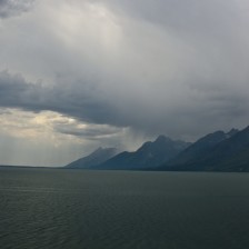
The Brahmaputra, which begins in the Qinghai province as the Yarlung Tsangpo River, is one major basin which has been historically impacted by such plans and targeted by major exploiters. In 1972, the Qinghai-Tibet Plateau Comprehensive Scientific Expedition took place in order to research damming potential in the Brahmaputra basin. The first dam ever built within this basin was the Zangmu, a gravity dam; construction is expected to end in 2015. Although its main purpose is producing hydroelectric power, it can also provide irrigation possibilities and flood control (Chellaney 2013). Five more dams are expected to follow the Zangmu on the Brahmaputra: the Guoduo, Dhongzhong, Ruxi, Linchang, and Xiangda (Chellaney 2013). China is also anticipating building ten new dams on the various tributaries of the Brahmaputra (Wirsing 2014). While such projects have the potential to create long-term benefits for China, other nations are also dependent on the Brahmaputra’s flow.
The three nations that directly share the Brahmaputra are China, India, and Bangladesh. These are the world’s first, second, and seventh most populated countries respectively, in addition to being water scarce and increasingly energy dependent (Wirsing 2014). Although China rarely comments on the various past and present construction projects within the Brahmaputra, or shares important hydrological information, the main issues can be identified.

China’s Population: La Historia con Mapas
In 1952, Mao stated: “[t]he south has a lot of water, the north little;…it is okay to lend a little water” (Chellaney 2013). The South-North Water project, otherwise known as the “Great Bend,” aims to move mass amounts of water from the rivers of southern China to the much more densely populated and agriculturally productive northern region. The plan was officially accepted in 2002, although the concept arouse during the 1950s. The idea was originally presented to Mao by Lin Yishan, the head of the Yangtze River Commission (Berkoff 2003). The subsequent fifty years consisted of various studies of the potential impacts and benefits of the project conducted by the Ministry of Water Resources. This “Great Bend” would not only be the largest surface water project ever-constructed in China, but also the world. If fully developed, there would be three different routes water would be diverted through: the Eastern, Central, and Western. A total of approximately 300,000 people would be displaced and complex environmental complications are a possibility (Berkoff 2003). However, such a large-scale transfer would provide numerous crucial benefits to China as a whole.

South Indian Plateau System: Wikiwand
The Brahmaputra’s water would theoretically be part of the Western Route. Compared to the others, “the West Route has better water quality and very limited needs for population relocation, but is more difficult to construct due to the harsh natural condition on the Tibetan Plateau” (Shao 2003). Beyond these factors, transboundary complexities would become an issue. Once the Brahmaputra’s flow leaves Chinese boundaries, it enters India’s Assamese plain (Wirsing 2014). If such transfer were to take place within China, this natural flow would be significantly altered, making India increasingly dependent on China for the resource.
While China is developing plans to transfer water to the North, India is simultaneously considering possibilities of moving Brahmaputra’s water further South to denser Indian populations (Wirsing 2014). Such projects promote the need for coordination between local governments and regional river administrators, as more than one nation is dependent on the resource (Ho 2013).
Currently, the Brahmaputra has become a prominent and permanent subject of discussion between India and China. Although China has never signed a multinational transboundary water treaty, while India has officially negotiated with Pakistan, Nepal and Bangladesh, potential for such agreements is rising (Chellaney 2013). While it is argued that “China’s dire water circumstances, combined with its impressive economic strength, military power and uniquely advantageous upper riparian position, give [India] little reason for optimism when it comes to river-sharing agreements with lower riparian countries,” other factors of their relationship must be considered (Wirsing 2014).
Additionally, increasing climate variability has intensified ecological impacts upon major water basins. While industrial water uses in China require three to ten times more water than industries in developed nations, agricultural demands have taken an increasingly massive amount of water than what was historically required. In terms of agricultural sectors, China uses a system that is based on the U.S.’s frameworks of the Riparian and Prior Appropriation doctrines. This theoretically signifies that domestic household, industrial, and agricultural needs remain the top priorities (Shao 2003).
As of last year Asia was withdrawing nearly seventy-four percent of total global freshwater for agricultural uses (Zhu 2014). Food production puts great demands on the Brahmaputra basin even more so due to the fact that increasing potential for sustained drought is leading to greatly diminished irrigation and crop production (Cai 2007). Furthermore, increased glacial melt, in combination with intensified deforestation, had emphasized demand for flood controlling dams due to down stream disasters, which have been more common compared to historical norms (Shao 2003). Such deforestation, or specifically the “removal of vegetation from river banks and…watersheds” also drains wetlands and changes the course of the river and its tributaries, as well as intensifying runoff rates (Chellaney 2013).
In combination with China’s history of major surface water project plans and growing environmental degradation, the Brahmaputra has become at a greater risk of irresponsible exploitation and ultimately the target of potential transboundary tension. However, the rise of such dilemmas does accompany the potential for unprecedented cooperation.
W O R K S C I T E D
Berkoff, Jeremy. 2003. “China: The South-North Water Transfer Project-Is It Justified?” Water Policy 5.
Cai, Ximing. 2007. “RISK IN IRRIGATION WATER SUPPLY AND THE EFFECTS ON FOOD PRODUCTION1.” JAWRA Journal of the American Water Resources Association 41 (3): 679 – 692. doi:10.1111/j.1752-1688.2005.tb03763.x.
Chellaney, Brahma. 2013. Water: Asia’s New Battleground. Washington, D.C: Georgetown University Press.
Ho, Selina. 2014. “River Politics: China’s Policies in the Mekong and the Brahmaputra in Comparative Perspective.” Journal of Contemporary China 23 (85): 1–20. doi:10.1080/10670564.2013.809974.
Shao, Xuejun, Hong Wang, and Zhaoyin Wang. 2003. “Interbasin Transfer Projects and Their Implications: A China Case Study.” International Journal of River Basin Management 1 (1): 5–14. doi:10.1080/15715124.2003.9635187.
Wirsing, Robert. 2014. “Global Water Forum | The Brahmaputra: Water Hotspot in Himalayan Asia.” http://www.globalwaterforum.org/2012/06/02/the-brahmaputra-water-hotspot-in-himalayan-asia/.
Zhu, XiuFang, AnZhou Zhao, YiZhan Li, and XianFeng Liu. 2014. “Agricultural Irrigation Requirements under Future Climate Scenarios in China.” Journal of Arid Land 7 (2): 224–37. doi:10.1007/s40333-014-0080-y.