
Colorado River: Geomorphology Science
It is widely recognized that the “Colorado River is the single most important source of water supply in the arid West” (Burness 1980). As expansion took hold in the early 1800s, the Colorado River basin was quickly established as a crucial resource for many of those who wished to create lives west of the Mississippi. The Colorado River itself passes through seven US states and two Mexican, although it is relied upon by many more. The basin has been developed with an “elaborate system of diversion and storage works [that] has become perhaps the most controlled and closely monitored watercourse in the entire world” (Burness 1980).
In 1872, the Prior Appropriation Doctrine was adopted in Colorado, a decision that has largely determined the ecological condition and overall management of the watershed today (Deason 2001). This doctrine basically states that water rights are unconnected to land ownership since these rights can be sold like other property on a ‘first come first serve basis.’ This allowed for agricultural, industrial, and household uses to take precedence while ecological concerns were not heavily comprehended or addressed at the time. This doctrine was enacted in place of the Riparian Doctrine, which is most present East of the Mississippi. The Riparian Doctrine states that “stream water may be used only upon riparian land, and riparian land is defined as embracing only land within the watershed” (Johnson 1964). This doctrine also takes into account riparian owner’s rights to future use of the water, in addition to their existing extractions.
John Wesley Powell, a famous explorer of the Colorado River, created his “Grand Plan” in 1890, mainly arguing against the Prior Appropriation system. He explained that the system would fragment land and water unnaturally. His ideal situation would have been to organize the entire ‘arid region’ of the west into “hydrographic districts, each to be a commonwealth within itself for the purpose of controlling and using the great values… establish[ing] local self government by hydrographic basins” (Gelt 2015). This view was ignored at the time, and the Prior Appropriation doctrine set the stage for future major management decisions.

ASH Main Canal: Water Education Foundation
The first major proposed water transfer for the purposes of agricultural development was to Imperial Valley, CA in 1859. At that time the proposal was not accepted, but in 1896, the Alamo Canal (Imperial Canal) construction began (Burness 1980). This system eventually turned into the Imperial Irrigation District. However, because it conducted water across Mexican territory, it had to be carried through a Mexican subsidiary (Kleinsorge 1941). The relationship between the U.S. and Mexico, in terms of the Colorado Basin, required intense cooperation early on.

Colorado Basin: NOAA’s Colorado Basin River Forecast Center

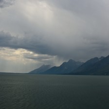
Lees Ferry: Arizona Heritage Waters
Another significant management decision was the Colorado River Compact, which was created in 1922. This compact divided the basin into the “Upper Basin” (parts of Arizona, Colorado, New Mexico, Utah and Wyoming which naturally drain into the basin, or rely upon diverted water above Lees Ferry) and the “Lower Basin” (parts of Arizona, California, Nevada, New Mexico, and Utah which naturally drain into the basin, or rely upon diverted water below Lees Ferry). The main purpose was to provide “equitable division and apportionment” of the Colorado River and all of its tributaries (Bannister 1923). The Upper Basin States committed to an Upper Colorado River Basin Compact in 1948, which specifically allocated the water in the Upper Basin among themselves. Colorado was allocated 51.75 percent. The Lower Basin states never reached such an agreement, and eventually the United States Supreme Court determined the percentages for the Lower Basin States (“Upper Colorado River Basin Compact” 1948).

Hoover Dam Bypass
Settlers of the west were dramatically impacted by the 1930’s Dust Bowl. The hardships that this drought created spurred major support for increased damming and use of the Colorado’s water. The Colorado River Storage Project was thus enacted spurring the construction of the Glen Canyon Dam, Flaming Gorge Dam, Navajo Dam, and others. After the Glen Canyon Dam’s construction in 1956, major dam building slowed (Hundley 2009). However, during this intense dam construction period, in 1935, the Hoover Dam was completed (Burness 1980). The Hoover Dam was part of the Boulder Canyon Project, a combination of projects including the Hoover, the All-American canal (which replaced the Alamo Canal), and others. “With the completion of the project, one of the greatest flood-control, reclamation, water-storage, and power projects in the history of the world will be realized. The mighty Colorado River…will have become comparatively tame and docile stream held in check to generate electric energy, to reclaim the irrigable lands of the desert, and to serve the growing populations of southern California and of the Southwest” (Kleinsoge 1941).
Specifically, due to Mexico’s reliance on the Colorado basin’s water, and the U.S.’s increasingly intense exploitation of it, Minute 242 was incorporated in 1973. This Minute worked to alleviate the problem of the level of salinity in the Colorado River’s discharge into Mexican territory (International Boundary and Water Commission 1973). This compromise also set the stage for more agreements between the U.S. and Mexico in the following decades.
In the 1970’s there were even more major changes in the west, largely prompted by growing population and economic expansion. This was followed by various environmental protection statues and programs (Sabatier 2005). As time progressed, stronger state and federal government influences developed, such as the role of the EPA. “The interest stems from the belief that the diverse sources of aquatic ecosystem impacts will best be brought under control through a combination of cooperative and mandatory measures tailored to the needs in specific watersheds with wholehearted support from watershed stakeholders” (Sabatier 2005).

Imperial Valley in Southern California: ALOS/ESA
Eventually eighty-five percent of the Colorado basin’s water was used in irrigated agriculture. For perspective, during the late seventies, if ten percent had decreased in agricultural usage, there would have been a sixty percent increase in water availability for all other uses (Stuart 1980). Due to agricultural expansion outside of the watershed’s direct area, construction of the Grand Ditch began in 1996. The purpose of this ‘ditch’ was to move water to the arid east side of the continental divide. The canal is fifteen miles long which drains an area of close to twenty miles. This is done between May and September when the flow of eleven headwater tributaries of the Colorado River are captured by the canal. The ecological impacts of the canal have been disputed from its inception (Visty 2004).
Continuing cooperation from Minute 242, Minute 319 was incorporated in 2012, attempting to ensure that both Mexico and the U.S. would have longterm access to the basin’s water. This Minute also recognized the impacts of climate change in combination with other demands upon the basin. It also solidified the minimum and maximum amount of water Mexico will receive based on reservoir holdings upstream. 319 additionally allocated for the purpose of improving environmental health (riparian and estuarine ecology) for the Colorado River as a whole. The US was also required to donate 21 million dollars to Mexico for “infrastructure and environmental projects” (International Boundary and Water Commission 2012). Basically, “the opportunity was observed to obtain mutual benefits by undertaking construction of international projects with joint investment by both countries that would allow for water conservation or the generation of new water sources to address the growing water demands in the basin and potential shortage conditions in the basin in the future” (Johnson 1928).
W O R K S C I T E D
Bannister, L. Ward. 1923. “Colorado River Compact.” The Cornell Law Quarterly 9: 388.
Burness, H. Stuart, and James P. Quirk. 1980. “Water Law, Water Transfers, and Economic Efficiency: The Colorado River.” Journal of Law and Economics 23 (1): 111–34.
Deason, Jonathan P, Theodore M Schad, and George William Sherk. 2001. “Water Policy in the United States: A Perspective.” Water Policy 3 (3): 175–92. doi:10.1016/S1366-7017(01)00011-3.
Gelt, Joe. 2015. “Managing Watersheds to Improve Land and Water | Wrrc.arizona.edu.” Accessed March 4. https://wrrc.arizona.edu/publications/arroyo-newsletter/managing-watersheds-improve-land-and-water.
Hundley, Norris. 2009. Water and the West: The Colorado River Compact and the Politics of Water in the American West. University of California Press.
International Boundary and Water Commission. 1973. “Minute 242.” Www.usbr.gov. http://www.usbr.gov/lc/region/pao/pdfiles/min242.pdf
International Boundary and Water Commission. 2012. “Minute 319.” Www.ibwc.gov. http://www.ibwc.gov/Files/Minutes/Minute_319.pdf
Johnson, Corwin W., and Larry D. Knippa. 1964. “Transbasin Diversion of Water.” Texas Law Review 43: 1035.
Johnson, Hiram W. 1928. “The Boulder Canyon Project.” Annals of the American Academy of Political and Social Science 135 (January): 150–56.
Kleinsorge, Paul Lincoln. 1941. The Boulder Canyon Project, Historical and Economic Aspects. Stanford University Press.
Sabatier, Paul, Will Focht, Mark Lubell, Zev Trachtenberg, Arnold Vedlitz, and Marty Matlock, eds. 2005. Swimming Upstream. MIT Press.
“Upper Colorado River Basin Compact.” 1948. Www.usbr.gov. https://www.usbr.gov/lc/region/pao/pdfiles/ucbsnact
Visty, Judy. 2004. “Effects of the Grand Ditch.” U.S. Department of the Interior.