In our second lab with one of my courses GEOL 340 Problems in Spatial Science, we looked at how emergency responders approach hazardous spill situations in populated areas or commuting routes using mapping software. The event is an overturned truck full of black powder (or gunpowder, as it is more commonly known). The setting of the spill is on an off-ramp at the confluence of two major interstate freeways. Go.
- First, we had to outline what we knew about the situation and what we needed to know. After finding out that the hazardous material was black powder, we looked up the MSDS (Materials Safety Data Sheet) to get the “stats” of this hazmat. According to the sheet, a spill of blackpowder required an evacuation radius of 0.5 – 1 mile, depending on whether or not it is heavily encased (in this case, not). Thus, we decided that we needed to do the following: pinpoint the location of the spill, close and redirect traffic going into the hazardous zone, and pick evacuation shelters outside of the hazardous zone.
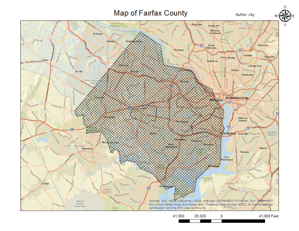
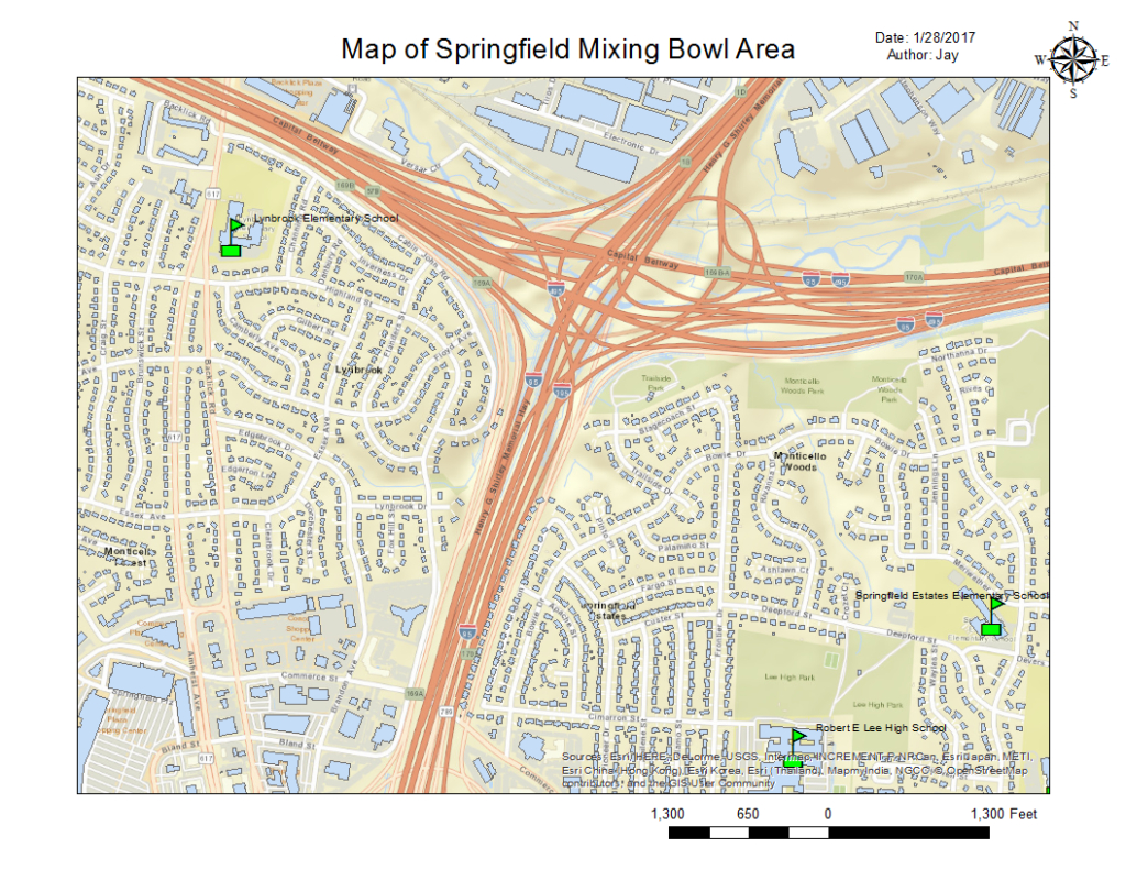
- The first map we produced using ArcGIS software was of Fairfax County, Virginia. This map itself is solely to help anyone involved in emergency planning understand geographically where the incident is taking place within the state of Virginia. Next, we created a map of the Springfield Mixing Bowl area, showing primarily roads and schools. This map helps others to understand the land-use of the area of the incident and begin pinpointing possible evacuation shelters and the size response team needed to evacuate residents.
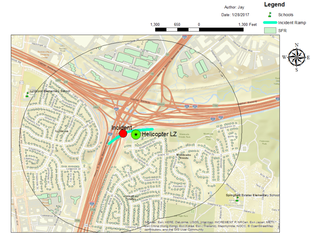
- Secondly, we pinpointed the site of the spill and the ramp that it occurred on. From there, we used the Multiple Ring Buffer tool to create buffer areas of 1 mile and 0.5 mile (shown below) around the ramp and clipped out all information about buildings that were outside of the hazardous zone. In addition, we pinpointed a landing zone (LZ) for a helicopter so that supplies and personnel (resources) could be transported quickly. The result was a map that could be shown to first responders including key information about which houses (SFR) were in danger, which schools served as feasible evacuation shelters, and the locations of the accident and helicopter LZ.
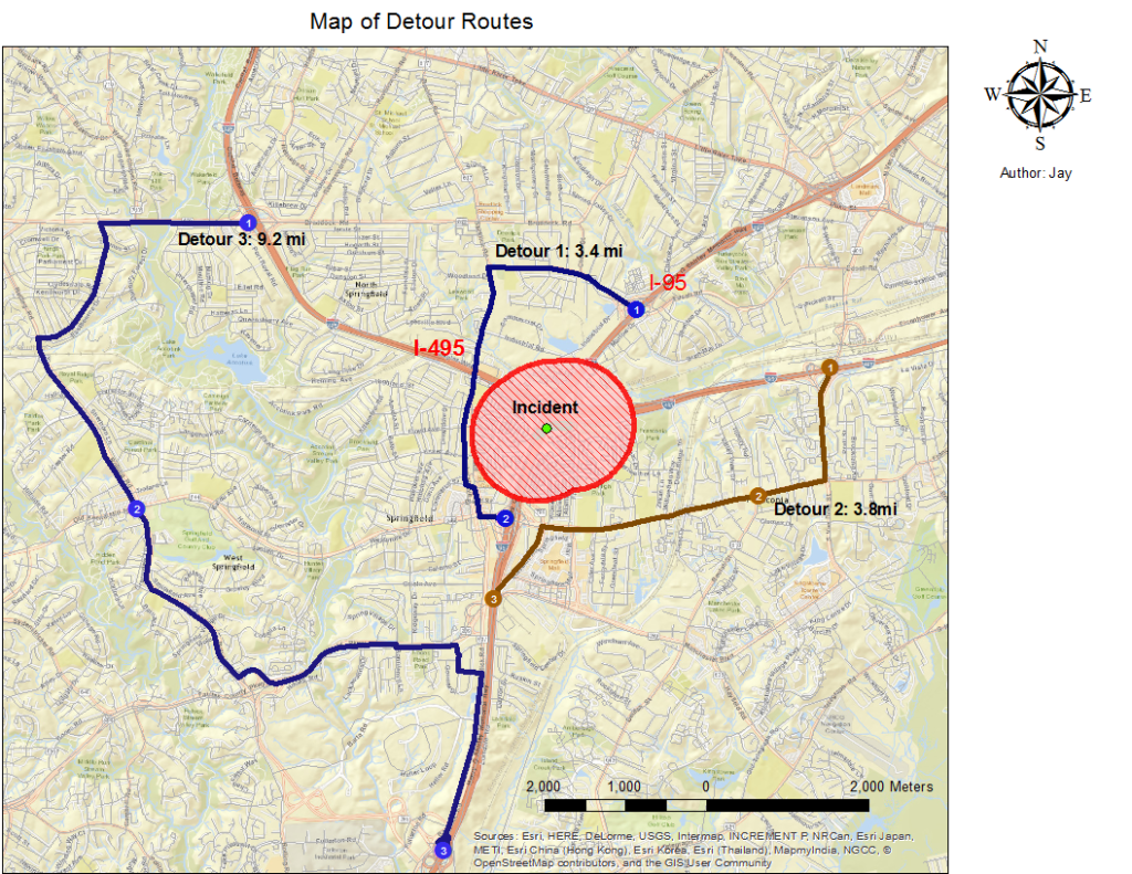
- To prevent traffic from flowing into this evacuation zone, we needed to calculate the best alternative routes so that mass congestion could be avoided and commuters could still get to their ultimate destinations. Using the network analysis tool in GIS, we created three detour routes: one for the I-95 and one each for those transferring onto the I-495 E and W from the I-95 N. The resulting map below contains all this information, including the estimated length in miles of the three routes.
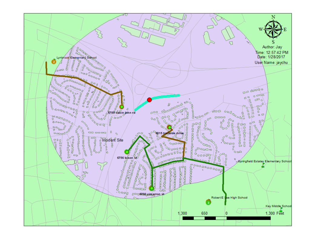
- While incoming traffic is redirected, we still need to figure out the evacuation routes for areas within the hazardous zone to get to the evacuation shelters. Using example residential addresses such as 6780 Cabin John Rd., we used the GIS network analysis route finder tool to highlight the best routes to the evacuation shelters, and the resulting map below contains information for residents in both the southwest and southeast quadrants to get to their respective evacuation shelters.
Conclusions & Reflections:
Using GIS, we analyzed a hazardous spill situation and managed to outline areas of concern, evacuation shelters, detour routes, evacuation routes, and helicopter landing zones. If created in an easily accessible format, this information will serve as the basis for first responders and emergency response teams and save a lot of time, time that could be used evacuating people and saving lives.
This second lab with GEOL 340 was an excellent exercise to practice some new and old GIS skills. The “real-world scenario” that we used for this exercise helped me conceptualize how ArcGIS has applications to more than just the scientific and urban planning communities, and this makes me even more satisfied that I am currently enrolled in this GIS-heavy course. I am continually surprised at the seemingly endless uses of and tools within GIS software!


___123___A Practice in Emergency Response: Springfields___123___