As a follow-up exercise to A Practice in Emergency Response: Springfield, the GEOL 340 class looked at another hazardous spill situation except this time in Mecklenburg, North Carolina involving chlorine gas! Much like the previous exercise, this scenario involved a hazardous spill in a popular commuting area, and we had to take the same steps in GIS to create maps for emergency responders.
- We first created a general map of Mecklenburg County to establish the general setting. This map is displayed below, with Mecklenburg County in maroon/purple.

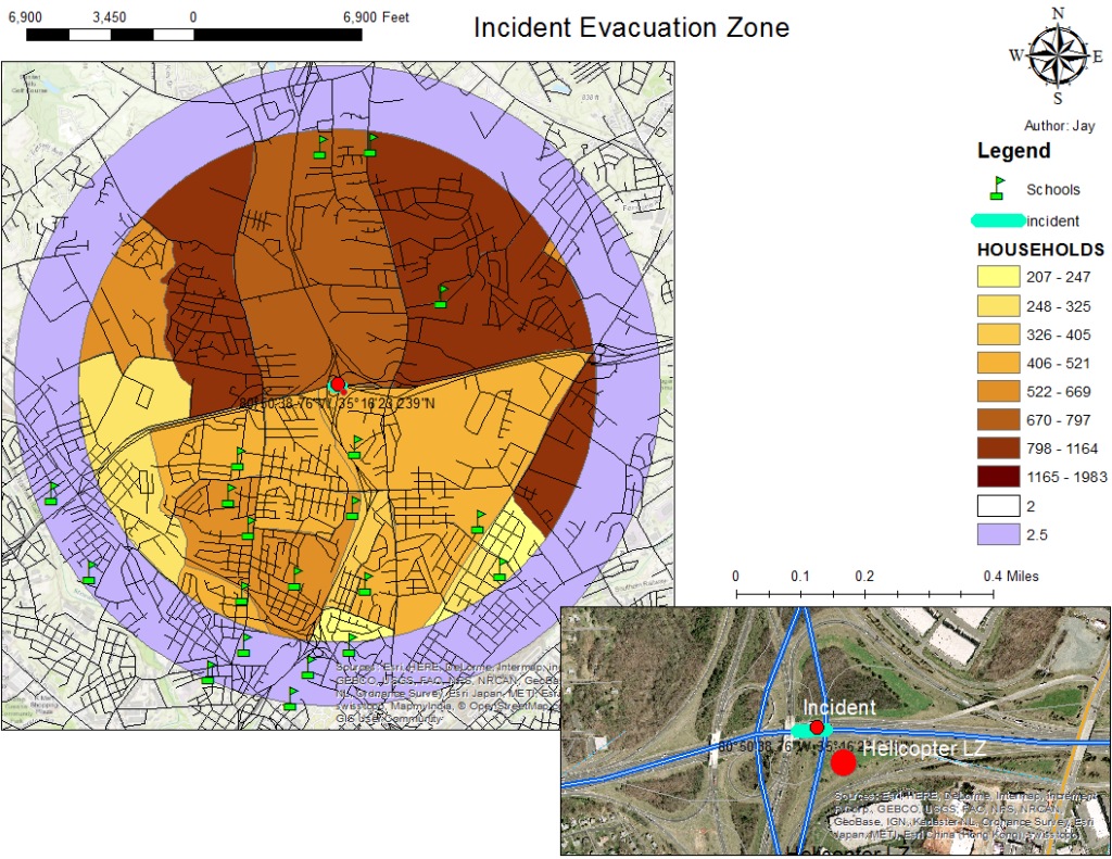
- Next we produced a map containing various bits of important information including: a buffer or evacuation zone of 2 miles (recommended in the MSDS for chlorine), household densities of areas within the buffer zone, school locations, the spill site, and a helicopter landing zone.
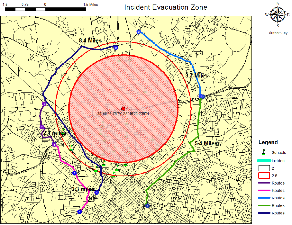
- We needed to direct incoming traffic so that no more people entered the 2-mile hazard zone, so the network analysis tool was used to create detour routes for commuters heading into the hazard zone. The result was a map with 5 detour routes.
- Now that we had pinpointed locations of importance such as evacuation shelters, helicopter LZ’s, and detour routes for incoming traffic, we had to create evacuation routes for those living inside the hazard zone. We created four evacuation routes using the network analysis tool and example addresses within the hazard zone. All routes led from residential addresses to evacuation shelters (schools) outside the 2-mile buffer.

Conclusions & Reflections
Little is different about this scenario compared to the previous hazardous spill example, and the outcomes or lessons learned are more or less the same. Still, this exercise was appropriate to help us cement our skills acquired in the previous hazardous spill example. Looking forward to new material!


Leave a Reply