Field-based experiences such as community excursions, site research, and overseas programs can be a fun and useful feature of digital scholarship. Here is a variety of location-aware mobile device apps for you to consider, generally available on both iOS and Android mobile platforms. Click to expand each image for quick help. We also have documented certain apps more extensively, including Flickr (image management) and Fulcrum (field surveys).
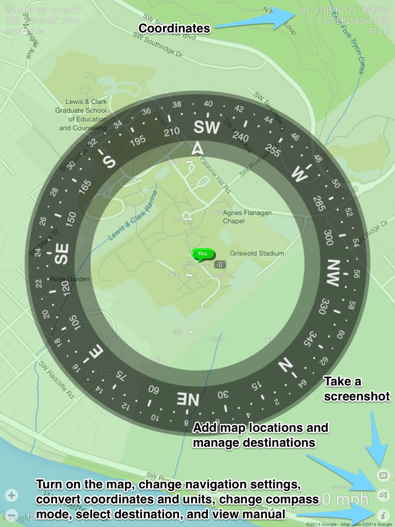
Commander Compass
Commander Compass Lite: Commander Compass offers a mobile compass which gives you many of the same functionalities as a handheld GPS unit. With a milspec compass, gyrocompass, speedometer, and inclinometer, you can gather all sorts of directional data all in one app. Much like a traditional GPS, you can also shoot a point and direct yourself to it and add placemarks (called “destinations” in the app).
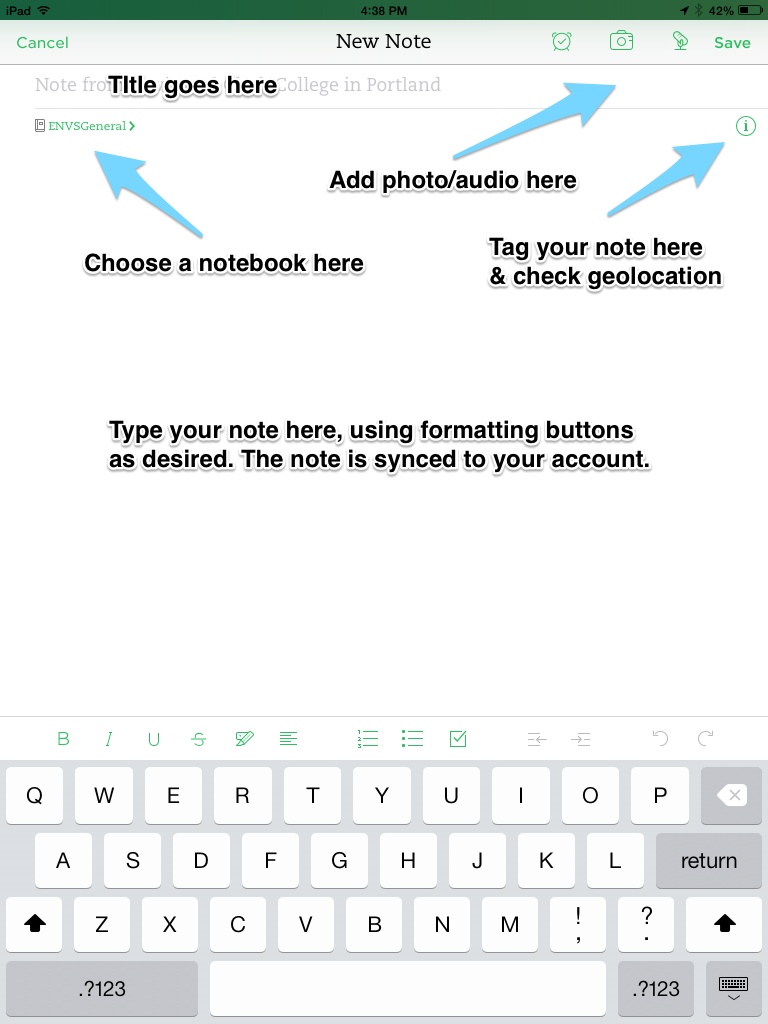
Evernote
Evernote: Evernote is designed to “…make modern life manageable, by letting you easily collect and find everything that matters.” Its mobile apps readily synchronize with your computer and other devices, and you can work in groups. The Evernote suite of apps includes Evernote itself for note-taking (including audio and still/motion imagery), Skitch for sketching and markup, and Penultimate for freehand work. In the field, Evernote can geotag your notes.
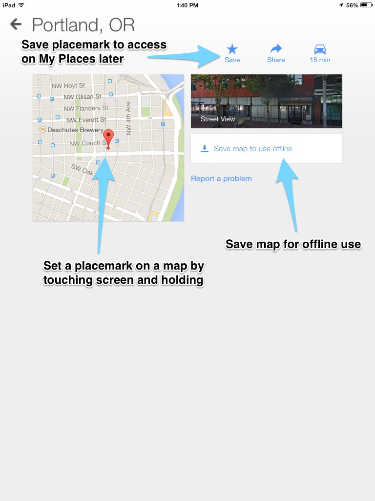
Google Maps
Google Maps: Google Maps Mobile gives you the option to search for places and get directions when lost, but many users do not know that the application can also be used offline. If your data usage is limited, you can view maps offline by taking a few steps before heading out into the field. Once the map is saved, you are able to view your current location, zoom in and out to read street names, and drop placemarks all while offline, although you are unable to search for locations or get directions. Certain regions of the world may or may not have offline map functionality so check before your departure. If you save placemarks on your device, you will be able to access these points in My Places under Starred or create a classic Google map with your saved placemarks to export as a KML.
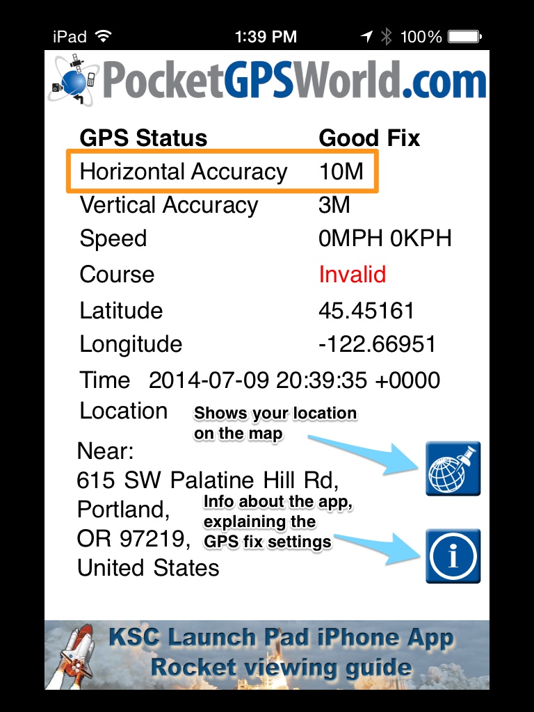
GPS Status
GPS Status: Sometimes it’s tough to know how accurately your mobile device’s GPS is functioning. GPS Status is a handy GPS diagnostic tool to cue you in to the accuracy of your device geolocation. Launch it and wait for the “fix” to improve at top, and pay special attention to horizontal accuracy.
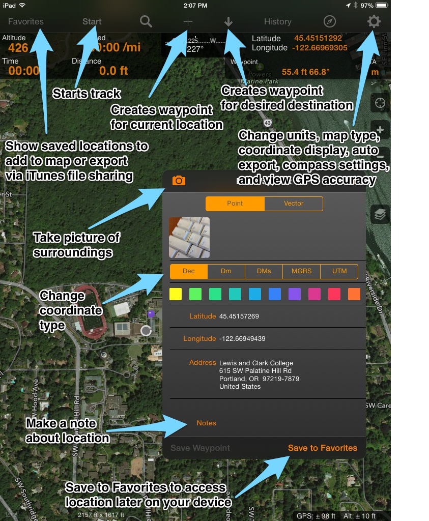
GPS Tracks
GPS Tracks HD: GPS Tracks HD allows you to track your route or set annotated placemarks for later export, using an online basemap. It’s a good solution for when you don’t need a custom basemap (see PDF Maps below for that), and when you’re mostly just storing tracks and locations in the field. See here for the manual.
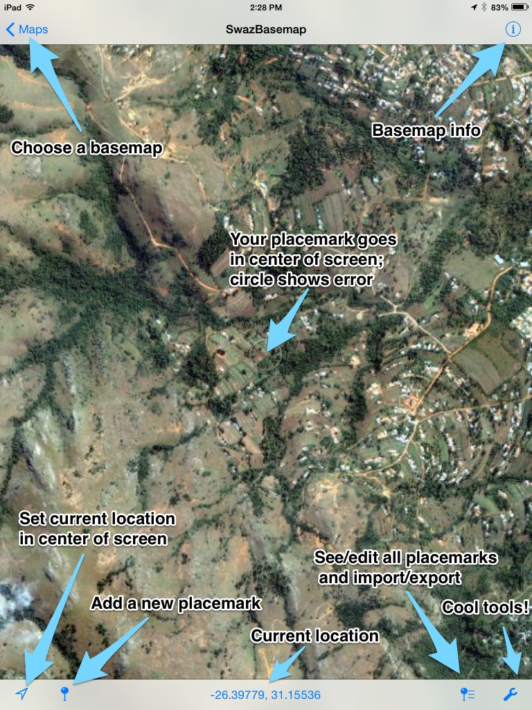
PDF Maps
PDF Maps: The PDFMaps app is “used by inviduals, companies and organizations for navigation, information collection, and sharing geographic information and knowledge.” You can download topos as offline basemaps, or upload your own basemaps. You can then add placemarks, images and text, and export your placemarks in a variety of formats including KML for mapping. See here for more info.